-
Abbottabad is the capital city of Abbottabad District in the Hazara region of eastern Khyber Pakhtunkhwa, Pakistan. It is about 120 kilometres (75 mi) north of Islamabad and Rawalpindi, and 150 kilometres (93 mi) east of Peshawar, at an altitude of 1,260 metres (4,134 ft). Kashmir lies to the east. The city is well known throughout Pakistan for its pleasant weather, high-standard educational Read more...
-
Shahdara Village is a village situated in the suburbs of Margalla Hills in Islamabad, Pakistan. It is 10 km away from the President’s House (or Aiwan-e-Sadr), the official office and residence of the President of Pakistan in the North-East and in the North of Barakhao, 7 km from Barakhao and 15 km from Faizabad Islamabad. The well-known Quaid-e-Azam University of Read more...
-
Great Place for travelers to Stay Standard Rooms Quality Meals Wifi Service Reasonable Price Room charges are average, service is good and yes rooms are clean. Also have small car parking area. Read more...
-
Located in Bellagio’s city centre and boasting lovely views over Lake Como, Hotel Bellagio offers free access to its gym. It also provides free WiFi in public areas. Read more...
-
Diplomat Hotel is set in Islamabad, 1.4 km from Pakistan Monument. The property is around 1.5 km from Pakistan Monument Museum and 1.6 km from Shakarparian. The property features a restaurant. Everything is very good in this hotel. Staff very co operative, Room service is excellent. This hotel is for all who want excellent cleanliness, comfort, best service and Read more...
-
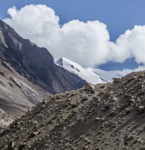
Mingli Sar is a mountain located in the Shimshal valley in Gilgit-Baltistan, Pakistan. The mountain, located in the Karakoram mountain range, is 6050 meters high and located at the southernmost part of the Pamir mountain range. It was first climbed in 1988 by the famous Pakistani climber Nazir Sabir. Shimshal lake sits at the base of the mountain. China is located to the north, while to the left is the Hindukush mountain range. K2 is located Read more...
-
Bunji or Boanzhe is a small town in Astore District, Gilgit-Baltistan, Pakistan. it is historically important being in the end of Dogra Rule before 1948 and on the brim of Ancient Yagistan.it was economically hub for Barter trade between Yagistan and Dogras. distance from Bunji to Gilgit is about 50 kilometres (31 mi) on the Karakoram Highway BHPP is a sub Read more...
-
Mitre Peak is a mountain in the Karakoram mountain range near Concordia in Gilgit-Baltistan, Pakistan. Mitre Peak marks the confluence of the branches of the Baltoro Glacier with the Gasherbrum branch arriving from the SE and the Godwin Austin branch arriving from the NE. It sits across from Broad Peak, the 12th highest mountain on Earth. Mitre Peak Cruises lead Read more...
-
FeaturedLeepa Valley is located in Azad Kashmir, 105 kilometres (65 mi) from Muzaffarabad. The valley is divided into the Reshian, Dao Khan, Leepa, and Chananian sections Leepa Valley was formerly part of Karnah, a tehsil of Kupwara district in Jammu and Kshmir, India. The valley is now part of Jhelum Valley District in Azad Kashmir, Pakistan. It has been an area Read more...
-
FeaturedKaghan Valley is an alpine-climate valley in Mansehra District of the Khyber Pakhtunkhwa Province of Pakistan. The tourists from across the country come to visit this place. The valley extends 155 kilometres (96 mi), rising from an elevation of 2,134 feet (650 m) to its highest point, the Babusar Pass, at 13,690 feet (4,170 m). Landslides caused by the devastating 2005 Read more...
-
The Soon Valley is in the north west of Khushab District, Punjab, Pakistan. Its largest settlement is the town of Naushera. The valley extends from the village of Padhrar to Sakesar, the highest peak in the Salt Range. The valley is 35 miles (56 km) long and has an average width of 9 miles (14 km). It covers a 300-square-mile (780 km2) area. Read more...
-
Babusar Pass or Babusar Top is a mountain pass at the north of the 150 km. (93 miles) long Kaghan Valley connecting it via the Thak Nala with Chilas on the Karakoram Highway (KKH). It is the highest point in the babusar valley that can be easily accessed by cars. Babusar Pass connects Gilgit Baltistan with Khyber Pakhtunkhwa province of Pakistan. Read more...
-
FeaturedKumrat is a valley in the Upper Dir District of Khyber Pakhtunkhwa the Province of Pakistan. It is one of the scenic valleys of Khyber Pakhtunkhwa and a picturesque spot for travelers. Every summer season thousands of tourists from different areas of the country visit to Kumrat valley and enjoy the greenery and cool weather. Kumrat is covered with green Read more...
-
FeaturedChitral is the capital of the Chitral District, situated on the Chitral River in northern Khyber Pakhtunkhwa, Pakistan. Chitral also served as the capital of the princely state of Chitral until 1969. Nothing definitive is recorded about the town’s first settlers. In the 3rd century CE, Kanishka, the Buddhist ruler of the Kushan empire, occupied Chitral. In the 4th century, Read more...


