places Categories: Attractions and Mountainsplaces Tags: Karakoram mountain, Karakoram mountain range, and Mingli Sar
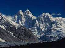
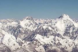
Mingli Sar is a mountain located in the Shimshal valley in Gilgit-Baltistan, Pakistan. The mountain, located in the Karakoram mountain range, is 6050 meters high and located at the southernmost part of the Pamir mountain range. It was first climbed in 1988 by the famous Pakistani climber Nazir Sabir. Shimshal lake sits at the base of the mountain. China is located to the north, while to the left is the Hindukush mountain range. K2 is located on the south eastern side of the valley.
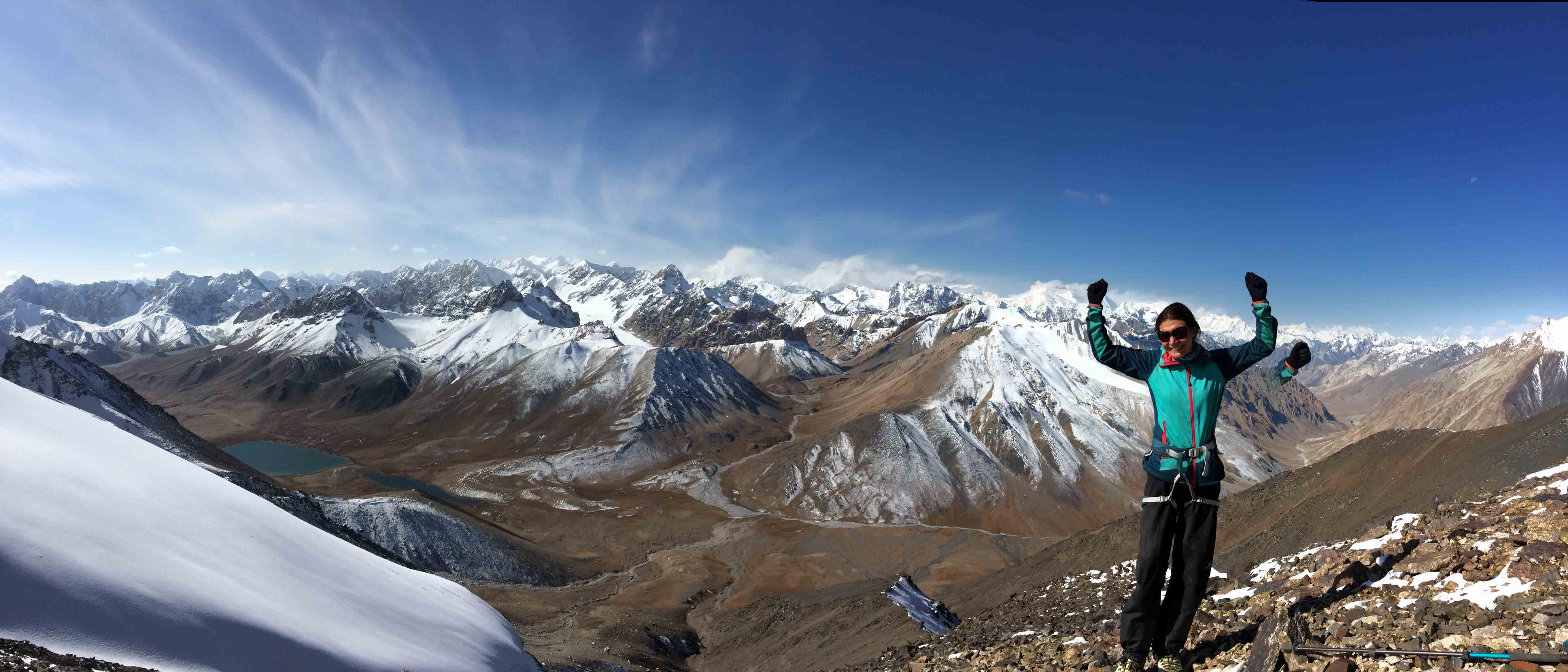
From Shimshal Pass we will attempt the mountain of Mingli Sar (translated as ‘the place above where the Yaks graze’.
Shimshal Minglik sar and Chapchigal pass trek offer best Kararakams views its mountains are some of the toughest, with some high virgin peaks with this background we take you to an ascent of a 6,050 meters high trekking Peak, The beautiful valley of Shimshal constitutes the northern most Pamir mountain ranges of Pakistan.
This is one of the most beautiful points in the valley as the Shimshal Lake surrounds it. The mountain of Mingli Sar is in front of it. From here one can have the glimpses of Karakoram Mountains, located just south of it. The world largest glaciers are located on the South eastern side of this valley. To the North is located the province of China while to the left are Hindu kush ranges and their beautiful pastures. K2 located on the southern eastern side of this valley. Shimshal Minglik sar and Chapchigal pass trekking begins from Islamabad and drive on the Karakoram Highway to Passu towards upper Hunza,
No Records Found
Sorry, no records were found. Please adjust your search criteria and try again.
Google Map Not Loaded
Sorry, unable to load Google Maps API.
-
- Karakoram,Shimshal and Boiber Valleys,Pakistan
Karakoram
Gilgit-Baltistan
Pakistan -
Kanjut Sar or Kunjudh Sar as pronounced in “Wakhi” is a mountain located in the Hispar Muztagh, a subrange of the Karakoram mountain range. Kunjudh Sar in wakhi language mean that which overlooks Kunjudh, or above Kunjudh, while Khujudh is the wakhi name for Lower Hunza. It is the 26th highest mountain on Earth and the 11th highest in Pakistan. Read more...
-
Trivor is one of the high peaks of the Hispar Muztagh, a subrange of the Karakoram range in the Gilgit-Baltistan of Pakistan. Its height is often given as 7,728 metres, but this elevation is not consistent with photographic evidence. The height given here is from a Russian 1:100,000 topographic map. There have been only two successful climbs of this peak; Read more...
-
FeaturedKhunyang Chhish or Kunyang Chhish (Urdu: کنیانگ چش)is the second-highest mountain in the Hispar Muztagh, a subrange of the Karakoram mountains of Pakistan. Alternate variations of the name include Kunyang Kish and Khiangyang Kish, among others. Its height, also sometimes given as 7,823 metres (25,666 ft), is ranked 21st in the world and 8th in Pakistan. Read more...
-
FeaturedDisteghil Sar is the highest mountain in the Hispar Muztagh, a subrange of the Karakoram mountain range, in Gilgit-Baltistan, which is part of the Kashmir region that is disputed by India and Pakistan. It is the 19th highest mountain on earth and the 7th highest peak in Pakistan. Destghil sar is a Wakhi language word, that means “above the inner ranch.” The mountain has an about 3 km long top ridge above 7400m with three Read more...
-
FeaturedYutmaru Sar is a mountain in the Hispar mountain range, a subrange of the Karakoram. At an elevation of 7,283 m (23,894 ft) it is the 88th highest mountain in the world. Yutmaru Sar is located in Gilgit-Baltistan, Pakistan. It was first climbed in 1980 Read more...
-